Voronoi logo

Mapping the Population Density of Brazil

Mapping the Population Density of Brazil

What We're Showing

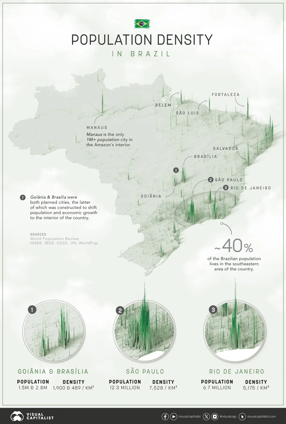
A map of Brazil with a population density overlay. The higher the spikes on the map, the higher the population density an area has. This type of visualization clearly shows settlement patterns within a selected geographical region.

The Overview

Brazil is ranked seventh in the world with a total population of 217 million people.

Similar to other large countries–like China, for example–the population is clustered in dense coastal cities, and thins out further into the interior of the continent. In fact, more than half of Brazil's population lives within 150 km of the coast.

Cities in Brazil are dense, but not by global standards. São Paulo is the largest, most dense city in Brazil, but is still only one-third as dense as Mumbai.

Points of Interest

  • The most populated portion of the country is easy to spot on the map. The largest cities, São Paulo and Rio de Janeiro, are only 430 km (270 miles) away from each other – roughly the same distance apart as Chicago and Detroit.
  • Further inland are the planned cities of Goiânia and Brasília. The latter is the master-planned capital of Brazil, which has a much lower population density than its coastal counterparts due to the urban planning principles used at the time.
  • Branching inward along the bottom of the country is the BR-364 highway. Smaller population centers are visible along the highway.
  • The Amazonian city of Manaus is easy to spot in the northwest of the country. The Amazon river is also clearly visible as low-level population density follows the course of the river as it flows through the vast rainforest.

What do you notice in this map?