Where Data Tells the Story
© Voronoi 2025. All rights reserved.

On the morning of April 3rd, Taiwan experienced its biggest earthquake in 25 years.
While the island nation is no stranger to tremors, the magnitude of this latest earthquake was strong enough to cause significant damage and claim lives. Here's what you need to know.
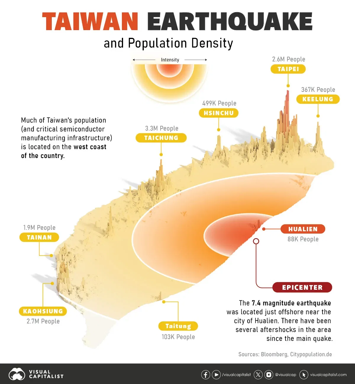
The epicentre of the quake was located just offshore in the eastern county of Hualien. The 7.4 magnitude earthquake had a shallow epicenter, which can lead to greater surface damage in the immediate area.
In the city of Hualien, which is the closest major population cluster near the epicenter, apartment buildings collapsed and hundreds of people were injured. An estimated X people are reported dead so far.
In the surrounding area, landslides occurred, and a tsunami warning was issued (and later downgraded). Light shaking was felt as far away as Japan's Okinawa Islands.
Taiwan's major population centers experienced moderate shaking, which caused disruptions. For example, the country's high-speed rail system suspended operations, and select semiconductor facilities were briefly evacuated.
After any major earthquake, aftershocks are a chief concern. After this most recent quake, there were nearly 20 aftershocks with a magnitude over 4.0, according to USGS. Since this part of Taiwan is mountainous and more sparsely populated, news will continue to be released about the full extent of damage. For now, local agencies are working to restore power to homes and rescue people trapped in collapsed structures.
As our map above shows, the eastern side of Taiwan is more sparsely populated than the west coast. While shaking was felt around most of the island, many of the cities and industrial sites (like Taiwan's critical semiconductor facilities) avoided severe damage.
As well, Taiwan has a high level of earthquake preparedness, so the death toll was much lower than it could have been.