Where Data Tells the Story
© Voronoi 2026. All rights reserved.
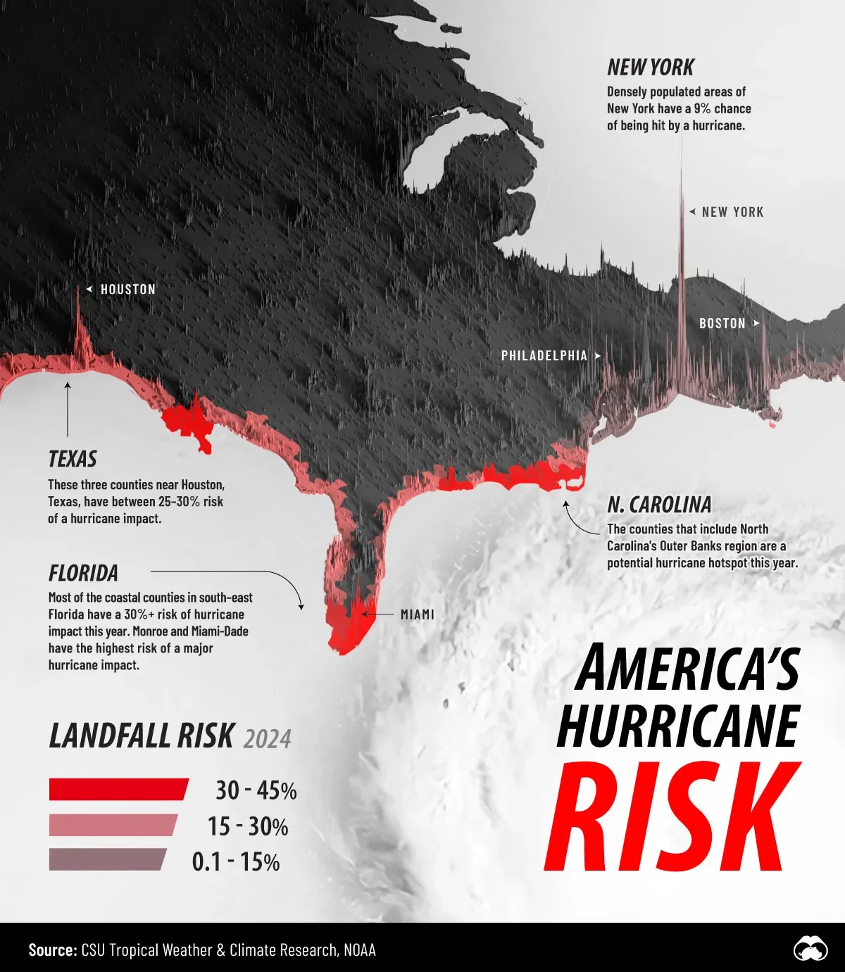
This map shows the risk of counties along the Atlantic coastline seeing a hurricane make landfall in 2024. The brighter the red, the higher the risk. As well, we've included population density spikes for context. After all, we're chiefly worried about hurricanes when they impact people and the places we live.
This data comes from the CSU Tropical Weather & Climate Research dataset. See the data tab for county-level risk numbers, as well as data from other states, provinces, and countries in North America.