🌏 Thailand Land Cover Map 2025
This map was created using Esri Land Cover 2025 (Sentinel-2) data combined with SRTM DEM elevation data to enhance terrain visualization and conduct spatial analysis using QGIS.
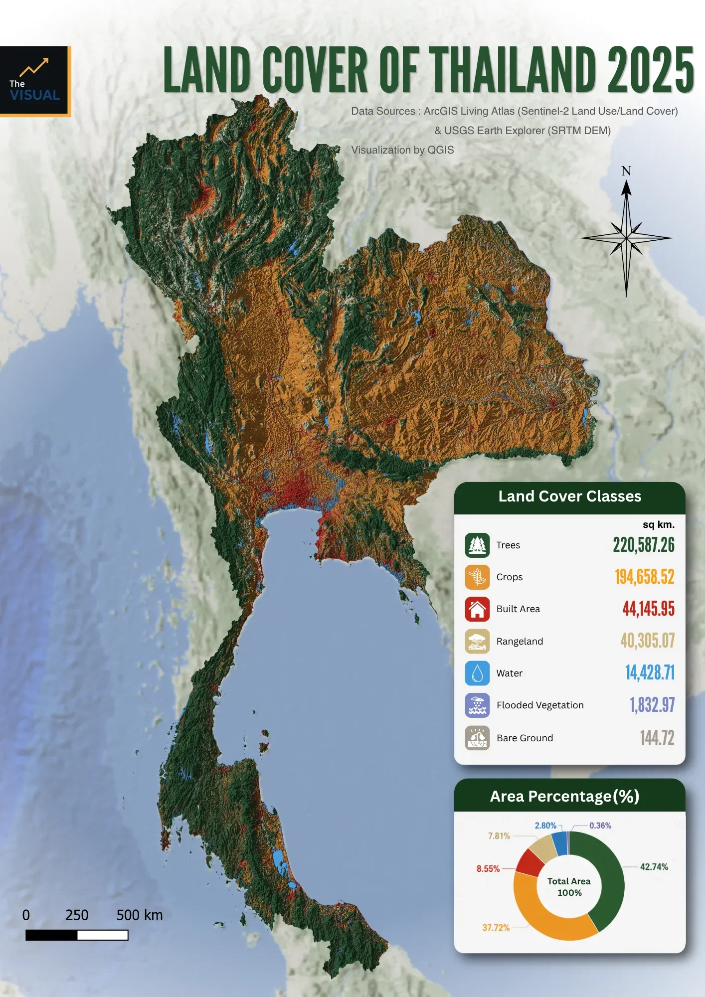
The analysis reveals that forest areas remain the dominant land cover type in Thailand (42.74%), mainly distributed across the mountainous regions of northern and western Thailand. Meanwhile, agricultural areas (37.72%) cover extensive lowland regions, particularly in the Central and Northeastern parts of the country.
Although urban and built-up areas (8.55%) represent a relatively small proportion of Thailand’s total area, they are highly concentrated in Bangkok, its surrounding metropolitan areas, and major coastal zones. These patterns demonstrate the strong relationship between topography, natural resources, and human activities in shaping Thailand’s land cover distribution.
🛰️ Data Sources: ArcGIS Living Atlas – Esri Land Cover 2025 (Sentinel-2), USGS Earth Explorer – SRTM DEM
🗺️ Spatial Analysis & Cartographic Design: QGIS